Solar Raster Photography


This is a picture of my brother's back yard. Its a panorama that spans from due south in the middle of the picture to north-east on the left and south-east on the right. Mostly you see trees and sky. That's a palm tree on the far right.  
   
  My brother, Peter Cunningham, made this image on a computer from data collected over half a year. That makes it a time exposure for sure. The moving sun illuminated the scene as it slowly progressed across the sky casting everything before it in silhouette. Passing clouds caused the static visible in parts of the open sky. My brother added the white dots at intervals of ten degrees of azimuth and elevation.

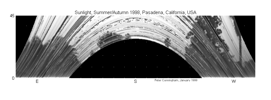
Here is another picture taken six months earlier. You will notice the trees were a little thinner and the weather a little more variable. Peter has three and a half years of data. That's enough for seven images.


Peter collects weather data, including solar irradiance, from a sensor array mounted on a post in his yard. He uses timestamps recorded with the data to synchronize its display with the calculable position of the sun in a process similar to the raster scanning of a television image. The stream of data from the sensor is in essence a slow-scan video signal, only the scan lines aren't straight and there is no camera at the source.

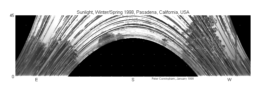
Let me say that once again. These pictures were taken without the aid of cameras or lenses. That may be obvious from the discussion above. Still, most observers find the fact startling. I encourage you to ponder their production, which relies on the motion of the earth, the properties of light, and the persistence of computers. Enjoy.

 
Ward Cunningham began collecting his own daylight data in the fall of 1998.
© 1999